
Straßdorf topographic map
Interactive map
Click on the map to display elevation.
About this map
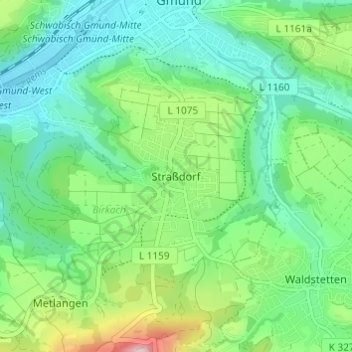
Name: Straßdorf topographic map, elevation, terrain.
Average elevation: 395 m
Minimum elevation: 308 m
Maximum elevation: 621 m
Other topographic maps
Click on a map to view its topography, its elevation and its terrain.
Kriegshäusle
Deutschland > Baden-Württemberg > Schwäbisch Gmünd > Straßdorf > Kriegshäusle
Kriegshäusle, Straßdorf, Schwäbisch Gmünd, Verwaltungsgemeinschaft Schwäbisch Gmünd, Ostalbkreis, Baden-Württemberg, 73529, Deutschland
Average elevation: 382 m