
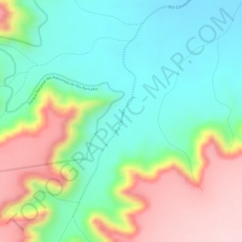
Rio Corrente topographic map
Interactive map
Click on the map to display elevation.
About this map
Name: Rio Corrente topographic map, elevation, terrain.
Average elevation: 636 m
Minimum elevation: 533 m
Maximum elevation: 796 m
Other topographic maps
Click on a map to view its topography, its elevation and its terrain.
Chapada das Mangabeiras
Chapada das Mangabeiras, Corrente, Região Geográfica Imediata de Corrente, Região Geográfica Intermediária de Corrente-Bom Jesus, Piauí, Região Nordeste, Brasil
Average elevation: 778 m