
Thank you for supporting this site ❤️
Make a donation
Make a donation
Aral topographic map
Click on the map to display elevation.
Thank you for supporting this site ❤️
Make a donation
Make a donation
About this map
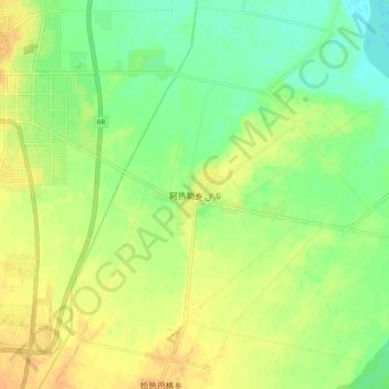
Name: Aral topographic map, elevation, terrain.
Location: Aral, Yarkant County, Kashgar Prefecture, Xinjiang, China (38.34122 77.27115 38.42122 77.35115)
Average elevation: 1,219 m
Minimum elevation: 1,203 m
Maximum elevation: 1,233 m
Thank you for supporting this site ❤️
Make a donation
Make a donation