
Thank you for supporting this site ❤️
Make a donation
Make a donation
Arabba topographic map
Click on the map to display elevation.
Thank you for supporting this site ❤️
Make a donation
Make a donation
About this map
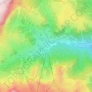
Name: Arabba topographic map, elevation, terrain.
Location: Arabba, Livinallongo del Col di Lana, Belluno, Veneto, Italy (46.47735 11.85534 46.51735 11.89534)
Average elevation: 1,931 m
Minimum elevation: 1,440 m
Maximum elevation: 2,540 m
Thank you for supporting this site ❤️
Make a donation
Make a donation