
Mount Slamet topographic map
Interactive map
Click on the map to display elevation.
About this map
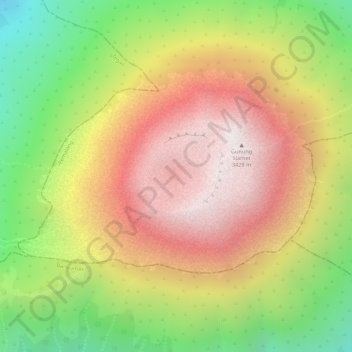
Name: Mount Slamet topographic map, elevation, terrain.
Location: Mount Slamet, Purwokerto, Central Java, Indonesia (-7.24150 109.21486 -7.24140 109.21496)
Average elevation: 2,950 m
Minimum elevation: 2,382 m
Maximum elevation: 3,412 m
Other topographic maps
Click on a map to view its topography, its elevation and its terrain.
Purwokerto
Indonesia > Central Java > Purwokerto
Purwokerto, Banyumas, Central Java, 53116, Indonesia
Average elevation: 277 m