
балка Вторая topographic map
Interactive map
Click on the map to display elevation.
About this map
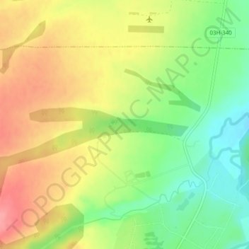
Name: балка Вторая topographic map, elevation, terrain.
Average elevation: 303 m
Minimum elevation: 260 m
Maximum elevation: 344 m
Other topographic maps
Click on a map to view its topography, its elevation and its terrain.
балка Третья
Russia > Krasnodar Krai > Махошевское сельское поселение
балка Третья, Махошевское сельское поселение, Mostovsky District, Krasnodar Krai, South Federal District, 352593, Russia
Average elevation: 298 m