
Thank you for supporting this site ❤️
Make a donation
Make a donation
The Woodlands topographic map
Click on the map to display elevation.
Thank you for supporting this site ❤️
Make a donation
Make a donation
About this map
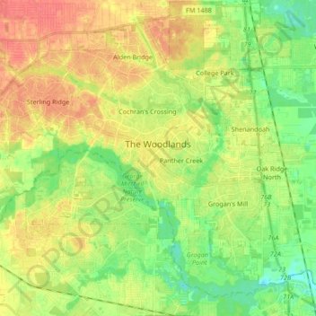
Name: The Woodlands topographic map, elevation, terrain.
Location: The Woodlands, Montgomery County, Texas, USA (30.10317 -95.60120 30.23057 -95.43430)
Average elevation: 47 m
Minimum elevation: 23 m
Maximum elevation: 72 m
Thank you for supporting this site ❤️
Make a donation
Make a donation