
Greater Poland Voivodeship topographic map
Interactive map
Click on the map to display elevation.
About this map
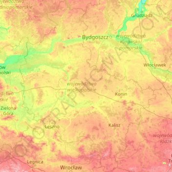
Name: Greater Poland Voivodeship topographic map, elevation, terrain.
Location: Greater Poland Voivodeship, Poland (51.10378 15.77629 53.65587 19.10502)
Average elevation: 110 m
Minimum elevation: 12 m
Maximum elevation: 372 m