
Ak-suu topographic map
Interactive map
Click on the map to display elevation.
About this map
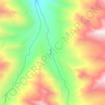
Name: Ak-suu topographic map, elevation, terrain.
Location: Ak-suu, Лейлекский район, Batken Region, Kyrgyzstan (39.60944 70.04314 39.66559 70.06617)
Average elevation: 3,318 m
Minimum elevation: 2,461 m
Maximum elevation: 4,349 m
Other topographic maps
Click on a map to view its topography, its elevation and its terrain.
ледник Конгур
ледник Конгур, через Мечту и Аллаудин, Кадамжайский район, Batken Region, Kyrgyzstan
Average elevation: 4,374 m