
Mai Châu District topographic map
Interactive map
Click on the map to display elevation.
About this map
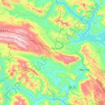
Name: Mai Châu District topographic map, elevation, terrain.
Location: Mai Châu District, Hoa Binh province, Vietnam (20.55722 104.83648 20.80558 105.15879)
Average elevation: 559 m
Minimum elevation: 70 m
Maximum elevation: 1,507 m
Mai Châu is a mountainous region located in Hòa Bình Province, approximately 135 km from Hanoi and 65 km from Hòa Bình. The East of Mai Chau borders Da Bac and Tan Lac districts, the West and the South border Quan Hoa district of Thanh Hoa province, and the North borders Van Ho district of Son La province. Mai Chau terrain is quite complex, divided by slits, streams and high mountains. According to the topographic characteristics, Mai Chau can be divided into two distinct areas: the low region (relatively flat terrain, fertile soil.) and the high region (with many high and rugged mountain ranges).