
Cleburne County topographic map
Interactive map
Click on the map to display elevation.
About this map
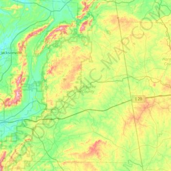
Name: Cleburne County topographic map, elevation, terrain.
Location: Cleburne County, Alabama, USA (33.46936 -85.88751 33.96436 -85.30444)
Average elevation: 311 m
Minimum elevation: 176 m
Maximum elevation: 640 m
Other topographic maps
Click on a map to view its topography, its elevation and its terrain.