
Kanchanaburi Province topographic map
Interactive map
Click on the map to display elevation.
About this map
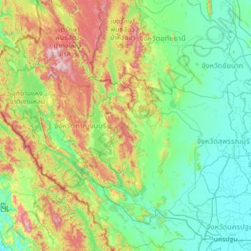
Name: Kanchanaburi Province topographic map, elevation, terrain.
Location: Kanchanaburi Province, Thailand (13.72614 98.18170 15.66301 99.89221)
Average elevation: 297 m
Minimum elevation: 0 m
Maximum elevation: 1,702 m