
Chihuahua topographic map
Interactive map
Click on the map to display elevation.
About this map
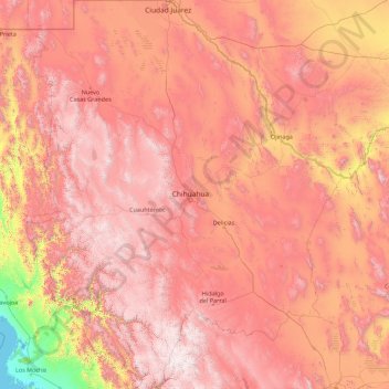
Name: Chihuahua topographic map, elevation, terrain.
Location: Chihuahua, Mexico (25.55866 -109.07498 31.78390 -103.30669)
Average elevation: 1,397 m
Minimum elevation: -1 m
Maximum elevation: 3,119 m
Other topographic maps
Click on a map to view its topography, its elevation and its terrain.
Sierra Madre Occidental
Sierra Madre Occidental, Guadalupe y Calvo, Chihuahua, Mexico
Average elevation: 2,945 m