
Saint Paul topographic map
Interactive map
Click on the map to display elevation.
About this map
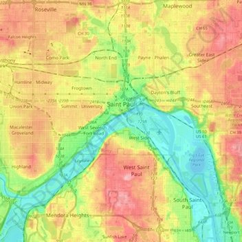
Name: Saint Paul topographic map, elevation, terrain.
Location: Saint Paul, Ramsey County, Minnesota, United States (44.88728 -93.20779 44.99202 -93.00432)
Average elevation: 266 m
Minimum elevation: 207 m
Maximum elevation: 334 m
The layout of city streets and roads has often drawn complaints. While he was Governor of Minnesota, Jesse Ventura appeared on the Late Show with David Letterman, and remarked that the streets were designed by "drunken Irishmen". He later apologized, though people had been complaining about the fractured grid system for more than a century by that point. Some of the city's road design is the result of the curve of the Mississippi River, hilly topography, conflicts between developers of different neighborhoods in the early city, and grand plans only half-realized. Outside of downtown, the roads are less confusing, but most roads are named, rather than numbered, increasing the difficulty for non-natives to navigate.