
Island County topographic map
Interactive map
Click on the map to display elevation.
About this map
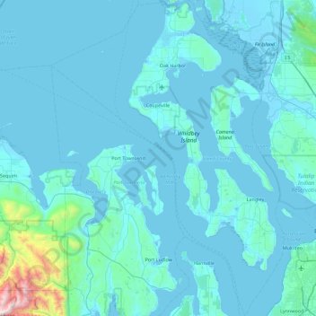
Name: Island County topographic map, elevation, terrain.
Location: Island County, Washington, United States of America (47.81745 -122.98899 48.41564 -122.32846)
Average elevation: 98 m
Minimum elevation: -3 m
Maximum elevation: 2,084 m
Other topographic maps
Click on a map to view its topography, its elevation and its terrain.
Olympic National Park
United States of America > Washington
Olympic National Park, Washington, United States of America
Average elevation: 412 m
Skykomish
United States of America > Washington > Skykomish
Skykomish, King County, Washington, United States of America
Average elevation: 441 m
Clallam County
United States of America > Washington
Clallam County, Washington, United States of America
Average elevation: 335 m