
Ubajay topographic map
Interactive map
Click on the map to display elevation.
About this map
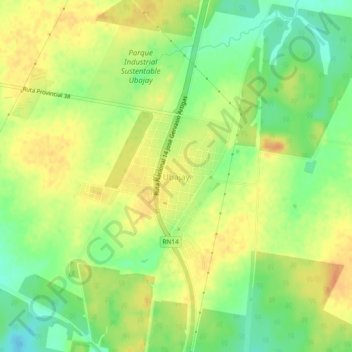
Name: Ubajay topographic map, elevation, terrain.
Average elevation: 50 m
Minimum elevation: 29 m
Maximum elevation: 65 m
Other topographic maps
Click on a map to view its topography, its elevation and its terrain.
Aldea San Gregorio
Argentina > Entre Ríos > Distrito Sexto
Aldea San Gregorio, Municipio de Ubajay, Distrito Sexto, Departamento Colón, Entre Ríos, Argentina
Average elevation: 35 m
Parque Nacional El Palmar
Argentina > Entre Ríos > Distrito Sexto
Parque Nacional El Palmar, Distrito Sexto, Departamento Colón, Entre Ríos, Argentina
Average elevation: 29 m