
Estuaire topographic map
Interactive map
Click on the map to display elevation.
About this map
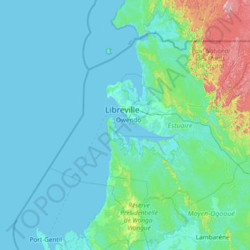
Name: Estuaire topographic map, elevation, terrain.
Location: Estuaire, Gabon (-0.52825 8.80975 1.06972 10.98809)
Average elevation: 75 m
Minimum elevation: -2 m
Maximum elevation: 1,050 m
Other topographic maps
Click on a map to view its topography, its elevation and its terrain.