
Lake St Clair topographic map
Interactive map
Click on the map to display elevation.
About this map
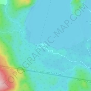
Name: Lake St Clair topographic map, elevation, terrain.
Location: Lake St Clair, Tasmania, Australia (-42.13579 146.15838 -42.09579 146.19838)
Average elevation: 774 m
Minimum elevation: 733 m
Maximum elevation: 1,012 m