
Limerick topographic map
Interactive map
Click on the map to display elevation.
About this map
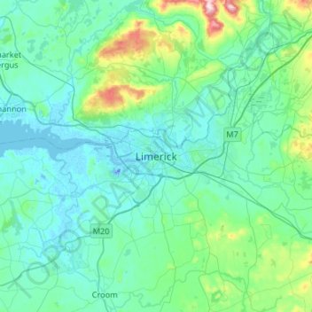
Name: Limerick topographic map, elevation, terrain.
Location: Limerick, County Limerick, Munster, V94 A9NX, Ireland (52.50125 -8.79012 52.82125 -8.47012)
Average elevation: 54 m
Minimum elevation: -26 m
Maximum elevation: 439 m