
Nyaung-U District topographic map
Interactive map
Click on the map to display elevation.
About this map
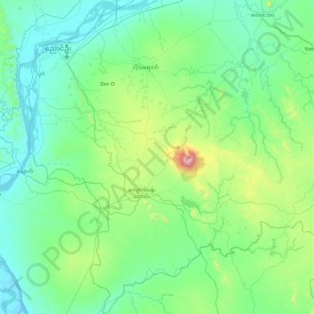
Name: Nyaung-U District topographic map, elevation, terrain.
Location: Nyaung-U District, Mandalay, Myanmar (20.54268 94.82973 21.31370 95.54460)
Average elevation: 255 m
Minimum elevation: 39 m
Maximum elevation: 1,480 m
Other topographic maps
Click on a map to view its topography, its elevation and its terrain.
Inn Gyi အင်းကြီး
Myanmar > Mandalay > Pyinoolwin Township
Inn Gyi အင်းကြီး, Pyinoolwin Township, Pyin Oo Lwin District, Mandalay, Myanmar
Average elevation: 1,104 m