
Rivière L'Assomption topographic map
Interactive map
Click on the map to display elevation.
About this map
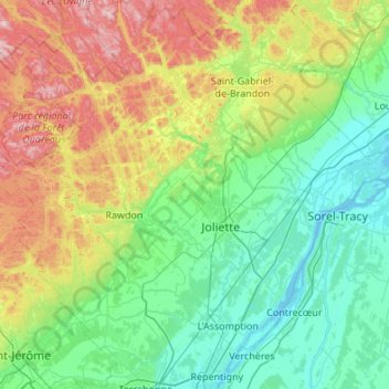
Name: Rivière L'Assomption topographic map, elevation, terrain.
Average elevation: 170 m
Minimum elevation: 1 m
Maximum elevation: 721 m
Other topographic maps
Click on a map to view its topography, its elevation and its terrain.
Notre-Dame de Lourdes
Canada > Québec > Joliette (MRC) > Notre-Dame-de-Lourdes
Average elevation: 70 m