
Kau Yi Chau topographic map
Interactive map
Click on the map to display elevation.
About this map
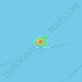
Name: Kau Yi Chau topographic map, elevation, terrain.
Location: Kau Yi Chau, Tai Wo Tsuen, Islands District, Hong Kong, PRC (22.28180 114.07380 22.28704 114.07991)
Average elevation: 1 m
Minimum elevation: 0 m
Maximum elevation: 96 m
Other topographic maps
Click on a map to view its topography, its elevation and its terrain.
Siu Kau Yi Chau
Siu Kau Yi Chau, Tai Wo Tsuen, Islands District, Hong Kong, PRC
Average elevation: 0 m