
Terengganu topographic map
Interactive map
Click on the map to display elevation.
About this map
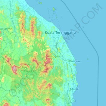
Name: Terengganu topographic map, elevation, terrain.
Location: Terengganu, Malaysia (3.93284 102.37847 5.96414 103.69100)
Average elevation: 143 m
Minimum elevation: -1 m
Maximum elevation: 2,125 m
Other topographic maps
Click on a map to view its topography, its elevation and its terrain.
Kenyir Dam
Kenyir Dam, Hulu Terennganu, Terengganu, Malaysia
Average elevation: 215 m