
Kinglake topographic map
Interactive map
Click on the map to display elevation.
About this map
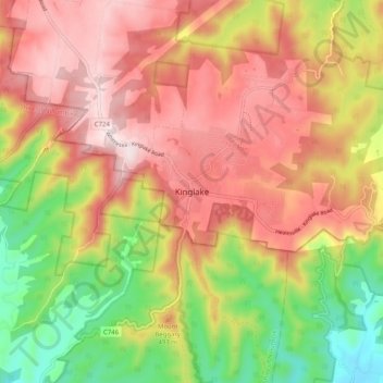
Name: Kinglake topographic map, elevation, terrain.
Location: Kinglake, Shire of Murrindindi, Victoria, 3763, Australia (-37.57274 145.30113 -37.49274 145.38113)
Average elevation: 416 m
Minimum elevation: 148 m
Maximum elevation: 639 m
Other topographic maps
Click on a map to view its topography, its elevation and its terrain.