Geolocate

Coomera topographic map

Interactive map

Click on the map to display elevation.

About this map

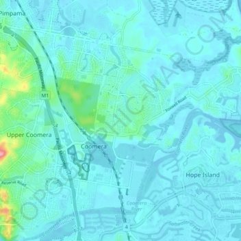
Name: Coomera topographic map, elevation, terrain.

Location: Coomera, Gold Coast City, Queensland, 4209, Australia (-27.87686 153.30268 -27.82058 153.38517)

Average elevation: 13 m

Minimum elevation: -2 m

Maximum elevation: 129 m

Other topographic maps

Click on a map to view its topography, its elevation and its terrain.

Avisford Park

Australia > Queensland > Gold Coast City

Average elevation: 18 m

Coomera River

Australia > Queensland > Gold Coast City

Average elevation: 25 m

Hart Park

Australia > Queensland > Gold Coast City

Average elevation: 2 m

Canowindra

Australia > Queensland > Gold Coast City

Average elevation: 20 m

Pages Pinnacle

Australia > Queensland > Gold Coast City

Average elevation: 189 m

Miami Beach

Australia > Queensland > Gold Coast City

Average elevation: 3 m

Twin Falls

Australia > Queensland > Gold Coast City

Average elevation: 754 m

Nerang River

Australia > Queensland > Gold Coast City

Average elevation: 318 m

Nerang River

Australia > Queensland > Gold Coast City

Average elevation: 12 m

Currumbin

Australia > Queensland > Gold Coast City

Average elevation: 8 m

Coomera

Australia > Queensland > Gold Coast City

Average elevation: 6 m

Mount Nathan

Australia > Queensland > Gold Coast City

Average elevation: 121 m

Hinze Dam

Australia > Queensland > Gold Coast City

Average elevation: 89 m

Studio Village

Australia > Queensland > Gold Coast City

Average elevation: 38 m

Gorge Falls

Australia > Queensland > Gold Coast City

Average elevation: 341 m

The Spit

Australia > Queensland > Gold Coast City

Average elevation: 2 m

Awonga Lake

Australia > Queensland > Gold Coast City

Average elevation: 5 m

Mowbray Park

Australia > Queensland > Gold Coast City

Average elevation: 7 m

Canyon Lookout

Australia > Queensland > Gold Coast City

Average elevation: 718 m