
Kedah topographic map
Interactive map
Click on the map to display elevation.
About this map
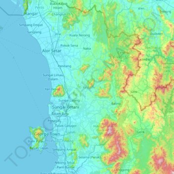
Name: Kedah topographic map, elevation, terrain.
Location: Kedah, Malaysia (5.07634 98.93721 6.54511 101.12794)
Average elevation: 191 m
Minimum elevation: -1 m
Maximum elevation: 2,127 m
Other topographic maps
Click on a map to view its topography, its elevation and its terrain.