
Lingga topographic map
Interactive map
Click on the map to display elevation.
About this map
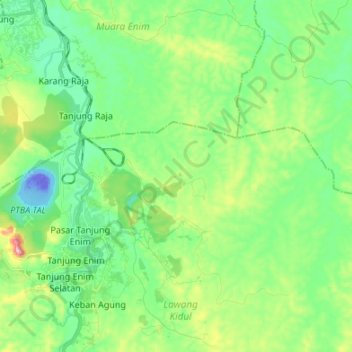
Name: Lingga topographic map, elevation, terrain.
Location: Lingga, South Sumatra, 31711, Indonesia (-3.74941 103.75924 -3.70849 103.89354)
Average elevation: 73 m
Minimum elevation: -68 m
Maximum elevation: 261 m
Other topographic maps
Click on a map to view its topography, its elevation and its terrain.
Lesung Batu
Indonesia > South Sumatra > Muara Enim > Lesung Batu
Lesung Batu, Tanjung Agung, Muara Enim, South Sumatra, Indonesia
Average elevation: 151 m