
Albany topographic map
Interactive map
Click on the map to display elevation.
About this map
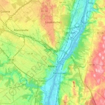
Name: Albany topographic map, elevation, terrain.
Location: Albany, Albany County, New York, USA (42.61379 -73.89810 42.72238 -73.72326)
Average elevation: 68 m
Minimum elevation: -2 m
Maximum elevation: 171 m