
Gorakhpur topographic map
Interactive map
Click on the map to display elevation.
About this map
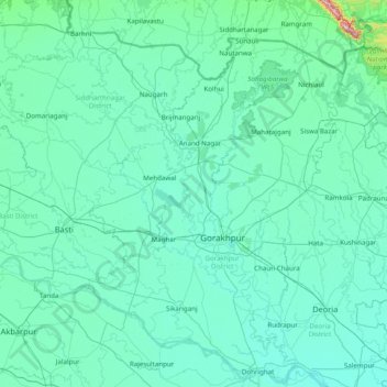
Name: Gorakhpur topographic map, elevation, terrain.
Location: Gorakhpur, Uttar Pradesh, India (26.27667 82.61000 27.55667 83.89000)
Average elevation: 88 m
Minimum elevation: 61 m
Maximum elevation: 818 m
Other topographic maps
Click on a map to view its topography, its elevation and its terrain.
Mountains
Mountains, Kānpur, Kanpur Dehat, Uttar Pradesh, India
Average elevation: 135 m
Jhansi
India > Uttar Pradesh > Jhansi
Jhansi, Jhānsi, Jhansi, Uttar Pradesh, 284001, India
Average elevation: 237 m