Geolocate

Municipio de Villa Gobernador Gálvez topographic map

Interactive map

Click on the map to display elevation.

About this map

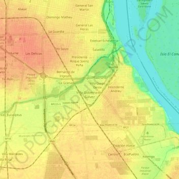
Name: Municipio de Villa Gobernador Gálvez topographic map, elevation, terrain.

Location: Municipio de Villa Gobernador Gálvez, Departamento Rosario, Santa Fe, S2124, Argentina (-33.04693 -60.68728 -32.99768 -60.56835)

Average elevation: 25 m

Minimum elevation: 0 m

Maximum elevation: 42 m

Other topographic maps

Click on a map to view its topography, its elevation and its terrain.

El Trébol

Argentina > Santa Fe > El Trébol

El Trébol, Municipio de El Trébol, Departamento San Martín, Santa Fe, S2535, Argentina

Average elevation: 97 m

Funes

Argentina > Santa Fe > Funes

Funes, Municipio de Funes, Departamento Rosario, Santa Fe, S2132, Argentina

Average elevation: 31 m