
Upper Oxford Township topographic map
Interactive map
Click on the map to display elevation.
About this map
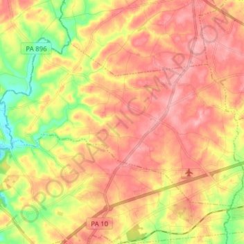
Name: Upper Oxford Township topographic map, elevation, terrain.
Location: Upper Oxford Township, Chester County, Pennsylvania, USA (39.80812 -76.02284 39.87486 -75.89659)
Average elevation: 153 m
Minimum elevation: 87 m
Maximum elevation: 199 m