
Tai Lei topographic map
Interactive map
Click on the map to display elevation.
About this map
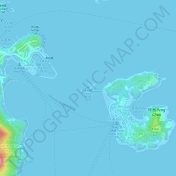
Name: Tai Lei topographic map, elevation, terrain.
Location: Tai Lei, Shan Ting Tsuen, Islands District, Hong Kong, PRC (22.28871 114.03171 22.29042 114.03431)
Average elevation: 5 m
Minimum elevation: -1 m
Maximum elevation: 134 m
Other topographic maps
Click on a map to view its topography, its elevation and its terrain.
Wu Ying Pai
Wu Ying Pai, Shan Ting Tsuen, Islands District, Hong Kong, PRC
Average elevation: 11 m