
Rhoose topographic map
Interactive map
Click on the map to display elevation.
About this map
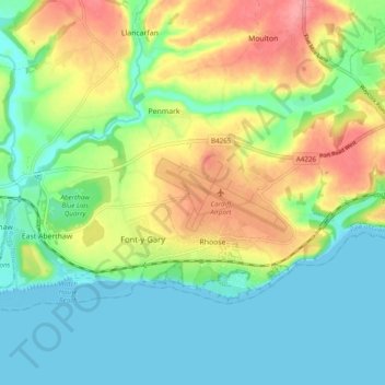
Name: Rhoose topographic map, elevation, terrain.
Location: Rhoose, Vale of Glamorgan, Wales, United Kingdom (51.37941 -3.39775 51.41625 -3.30065)
Average elevation: 31 m
Minimum elevation: 0 m
Maximum elevation: 84 m