
Sittard topographic map
Interactive map
Click on the map to display elevation.
About this map
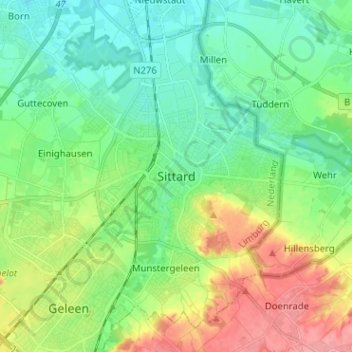
Name: Sittard topographic map, elevation, terrain.
Location: Sittard, Limburg, Nederland, 6131 CV, Nederland (50.95742 5.82666 51.03742 5.90666)
Average elevation: 59 m
Minimum elevation: 32 m
Maximum elevation: 113 m
Other topographic maps
Click on a map to view its topography, its elevation and its terrain.
Kollenberg
Kollenberg, Sittard, Sittard-Geleen, Limburg, Nederland, 6132 AX, Nederland
Average elevation: 66 m