
Beesel topographic map
Interactive map
Click on the map to display elevation.
About this map
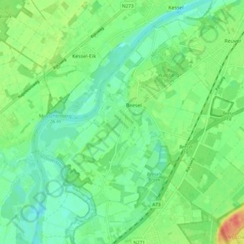
Name: Beesel topographic map, elevation, terrain.
Location: Beesel, Limburg, Nederland (51.24256 6.00529 51.28719 6.09471)
Average elevation: 25 m
Minimum elevation: 9 m
Maximum elevation: 55 m
Other topographic maps
Click on a map to view its topography, its elevation and its terrain.
Bussereind
Bussereind, Beesel, Limburg, Nederland, 5954 GB, Nederland
Average elevation: 25 m