
Cottessen topographic map
Interactive map
Click on the map to display elevation.
About this map
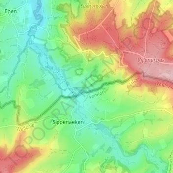
Name: Cottessen topographic map, elevation, terrain.
Location: Cottessen, Vijlen, Vaals, Limburg, Nederland, 6294 NE, Nederland (50.73921 5.92005 50.77921 5.96005)
Average elevation: 183 m
Minimum elevation: 107 m
Maximum elevation: 296 m
Other topographic maps
Click on a map to view its topography, its elevation and its terrain.