Geolocate

Gennep topographic map

Interactive map

Click on the map to display elevation.

About this map

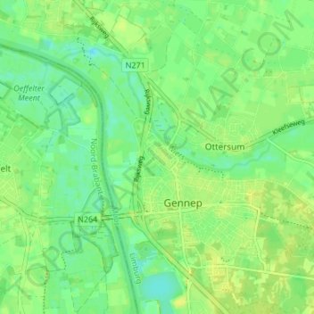
Name: Gennep topographic map, elevation, terrain.

Location: Gennep, Limburg, Nederland (51.68038 5.94672 51.72190 6.00390)

Average elevation: 13 m

Minimum elevation: 4 m

Maximum elevation: 19 m

Other topographic maps

Click on a map to view its topography, its elevation and its terrain.

Milsbeek

Nederland > Limburg > Gennep

Milsbeek, Gennep, Limburg, Nederland

Average elevation: 20 m

Ottersum

Nederland > Limburg > Gennep

Ottersum, Gennep, Limburg, Nederland

Average elevation: 14 m

Heijen

Nederland > Limburg > Gennep

Heijen, Gennep, Limburg, Nederland

Average elevation: 14 m

Ven-Zelderheide

Nederland > Limburg > Gennep

Ven-Zelderheide, Gennep, Limburg, Nederland

Average elevation: 15 m