
Nordeste topographic map
Interactive map
Click on the map to display elevation.
About this map
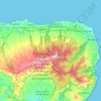
Name: Nordeste topographic map, elevation, terrain.
Location: Nordeste, São Miguel, Açores, Portugal (37.77366 -25.30855 37.86284 -25.13417)
Average elevation: 317 m
Minimum elevation: 0 m
Maximum elevation: 1,089 m
Other topographic maps
Click on a map to view its topography, its elevation and its terrain.