
Thank you for supporting this site ❤️
Make a donation
Make a donation
Hoogstraten topographic map
Click on the map to display elevation.
Thank you for supporting this site ❤️
Make a donation
Make a donation
Hoogstraten
De Romeinen plachten hun wegen over hoogten aan te leggen. In het Engels duidt het woord highway (Oudengels: heahweg, heahstræte = high street) een hoofdweg aan tussen twee steden en vroeger vooral oude Romeinse wegen die zoals gezegd veelal hooggelegen waren.
Thank you for supporting this site ❤️
Make a donation
Make a donation
About this map
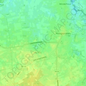
Name: Hoogstraten topographic map, elevation, terrain.
Location: Hoogstraten, Turnhout, Antwerpen, Vlaanderen, 2320, België (51.37555 4.70928 51.41619 4.78532)
Average elevation: 19 m
Minimum elevation: 10 m
Maximum elevation: 26 m
Thank you for supporting this site ❤️
Make a donation
Make a donation
Other topographic maps
Click on a map to view its topography, its elevation and its terrain.