
São José do Rio Preto topographic map
Interactive map
Click on the map to display elevation.
São José do Rio Preto
The city is located on the region between the rivers Grande, Paraná and Tietê. The Vegetation is a mixture of Cerrado (Grass savanna) with traces of the Mata Atlântica (Atlantic Forest). The topography is formed by a slightly undulated relief, with a medium elevation of 489 m (1,604 ft).
About this map
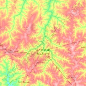
Name: São José do Rio Preto topographic map, elevation, terrain.
Average elevation: 527 m
Minimum elevation: 430 m
Maximum elevation: 602 m