
Entre Ríos Province topographic map
Interactive map
Click on the map to display elevation.
About this map
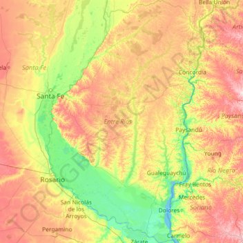
Name: Entre Ríos Province topographic map, elevation, terrain.
Location: Entre Ríos Province, Argentina (-34.03919 -60.77165 -30.15896 -57.79739)
Average elevation: 53 m
Minimum elevation: -1 m
Maximum elevation: 206 m
Other topographic maps
Click on a map to view its topography, its elevation and its terrain.