
Tongren City topographic map
Interactive map
Click on the map to display elevation.
About this map
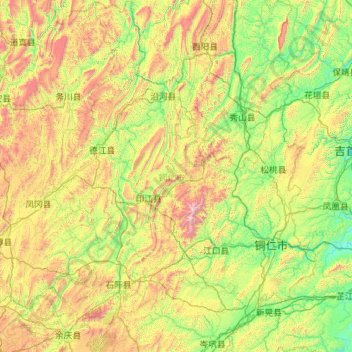
Name: Tongren City topographic map, elevation, terrain.
Location: Tongren City, Guizhou, 558000, China (27.12583 107.74963 29.09461 109.47003)
Average elevation: 743 m
Minimum elevation: 183 m
Maximum elevation: 2,533 m
Other topographic maps
Click on a map to view its topography, its elevation and its terrain.