Geolocate

菏泽市 topographic map

Interactive map

Click on the map to display elevation.

About this map

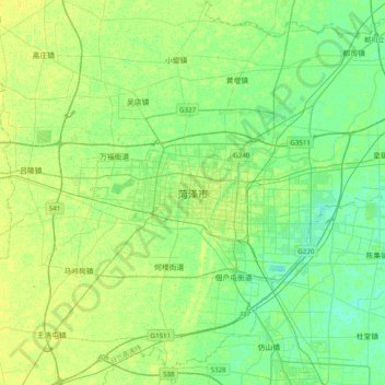
Name: 菏泽市 topographic map, elevation, terrain.

Location: 菏泽市, 牡丹区, 菏泽市, 山东省, 中国 (35.08773 115.28648 35.40773 115.60648)

Average elevation: 53 m

Minimum elevation: 46 m

Maximum elevation: 59 m

Other topographic maps

Click on a map to view its topography, its elevation and its terrain.

张坊

中国 > 山东省 > 菏泽市

张坊, 菏泽市, 山东省, 中国

Average elevation: 41 m

黄坛

中国 > 山东省 > 菏泽市

黄坛, 菏泽市, 山东省, 中国

Average elevation: 42 m

芦墓

中国 > 山东省 > 菏泽市

芦墓, 菏泽市, 山东省, 中国

Average elevation: 42 m

管庄

中国 > 山东省 > 菏泽市

管庄, 菏泽市, 山东省, 中国

Average elevation: 47 m

鱼跃龙门

中国 > 山东省 > 菏泽市

鱼跃龙门, 环湖南路, 单县, 菏泽市, 山东省, 中国

Average elevation: 53 m

郓城县

中国 > 山东省 > 菏泽市

郓城县, 菏泽市, 山东省, 中国

Average elevation: 45 m

南城街道

中国 > 山东省 > 菏泽市

南城街道, 单县, 菏泽市, 山东省, 274300, 中国

Average elevation: 45 m

麒麟镇

中国 > 山东省 > 菏泽市 > 麒麟镇

麒麟镇, 菏泽市, 山东省, 中国

Average elevation: 39 m