
Bethany topographic map
Interactive map
Click on the map to display elevation.
About this map
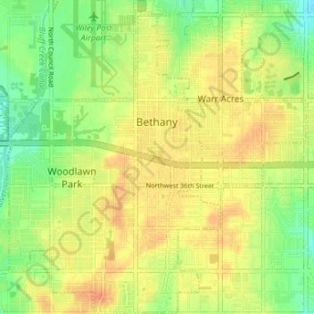
Name: Bethany topographic map, elevation, terrain.
Location: Bethany, Oklahoma County, Oklahoma, United States of America (35.48603 -97.66345 35.53932 -97.61896)
Average elevation: 396 m
Minimum elevation: 375 m
Maximum elevation: 412 m