
Burnie topographic map
Interactive map
Click on the map to display elevation.
About this map
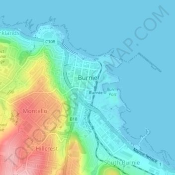
Name: Burnie topographic map, elevation, terrain.
Location: Burnie, City of Burnie, Tasmania, 7320, Australia (-41.06136 145.89749 -41.04651 145.92141)
Average elevation: 33 m
Minimum elevation: 0 m
Maximum elevation: 148 m
Other topographic maps
Click on a map to view its topography, its elevation and its terrain.