
Chittoor topographic map
Interactive map
Click on the map to display elevation.
About this map
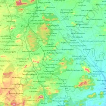
Name: Chittoor topographic map, elevation, terrain.
Location: Chittoor, Andhra Pradesh, 517001, India (13.05069 79.03481 13.27001 79.23176)
Average elevation: 309 m
Minimum elevation: 223 m
Maximum elevation: 550 m
Other topographic maps
Click on a map to view its topography, its elevation and its terrain.