
Montgomery County topographic map
Interactive map
Click on the map to display elevation.
About this map
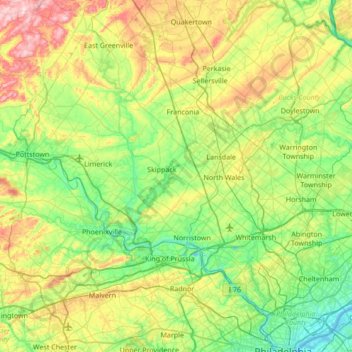
Name: Montgomery County topographic map, elevation, terrain.
Location: Montgomery County, Pennsylvania, United States of America (39.97698 -75.69699 40.44700 -75.01509)
Average elevation: 109 m
Minimum elevation: -2 m
Maximum elevation: 363 m
Other topographic maps
Click on a map to view its topography, its elevation and its terrain.
Dalmatia
United States of America > Pennsylvania > Dalmatia
Dalmatia, Northumberland County, Pennsylvania, 17017, United States of America
Average elevation: 172 m
Bedford County
United States of America > Pennsylvania
Bedford County, Pennsylvania, United States of America
Average elevation: 491 m
Monongahela
United States of America > Pennsylvania > Monongahela
Monongahela, Washington County, Pennsylvania, 15063, United States of America
Average elevation: 286 m