
Foss topographic map
Interactive map
Click on the map to display elevation.
About this map
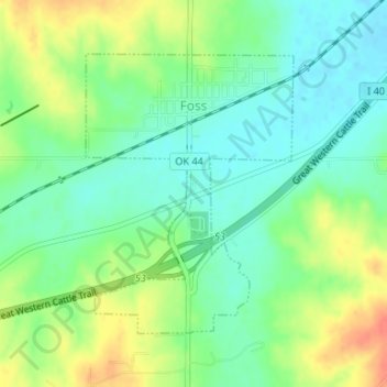
Name: Foss topographic map, elevation, terrain.
Location: Foss, Washita County, Oklahoma, United States of America (35.43810 -99.17885 35.45806 -99.16245)
Average elevation: 508 m
Minimum elevation: 489 m
Maximum elevation: 538 m
Foss is located at 35°27′12″N 99°10′15″W / 35.45333°N 99.17083°W / 35.45333; -99.17083 (35.453305, -99.170754), elevation 1,629 feet (497 m). According to the United States Census Bureau, the town has a total area of 0.7 square miles (1.8 km2), all land. Foss State Park is located nearby.