
Saddle Lake topographic map
Interactive map
Click on the map to display elevation.
About this map
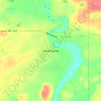
Name: Saddle Lake topographic map, elevation, terrain.
Location: Saddle Lake, Alberta, Canada (53.94914 -111.70872 53.98914 -111.66872)
Average elevation: 620 m
Minimum elevation: 592 m
Maximum elevation: 652 m