
Décharge du lac Stukely topographic map
Interactive map
Click on the map to display elevation.
About this map
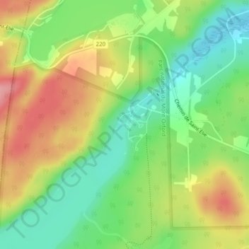
Name: Décharge du lac Stukely topographic map, elevation, terrain.
Average elevation: 321 m
Minimum elevation: 269 m
Maximum elevation: 385 m
Other topographic maps
Click on a map to view its topography, its elevation and its terrain.
Parc national du Mont-Orford
Parc national du Mont-Orford, Chemin du Parc, Orford, Memphrémagog, Estrie, Québec, J1X 0X4, Canada
Average elevation: 336 m
Pic de l'Ours
Pic de l'Ours, Orford, Memphrémagog, Estrie, Québec, Canada
Average elevation: 513 m